Upper Peninsula Rivers Rise Above Flood Stage as Snowmelt Continues
Spring snowmelt pushes multiple Upper Peninsula rivers above flood stage, threatening campgrounds and recreational areas across the region.
MARQUETTE, MICHIGAN — Multiple rivers across Michigan’s Upper Peninsula have exceeded flood stage or are approaching dangerous levels as spring snowmelt continues to drive elevated water flows, prompting flood advisories from the National Weather Service.
The Tahquamenon River near Paradise reached 10.0 feet at 2:45 PM EDT on Tuesday, surpassing the flood stage of 10.0 feet and exceeding the bankfull stage of 9.5 feet. The Sturgeon River near Nahma Junction also climbed to 9.7 feet, approaching the 10.0-foot flood stage mark.
The Paint River at Crystal Falls remains under a flood advisory until Friday morning, while the Middle Branch Escanaba River at Humboldt and Tahquamenon River advisories continue until further notice.
Flooding Impacts Recreational Areas
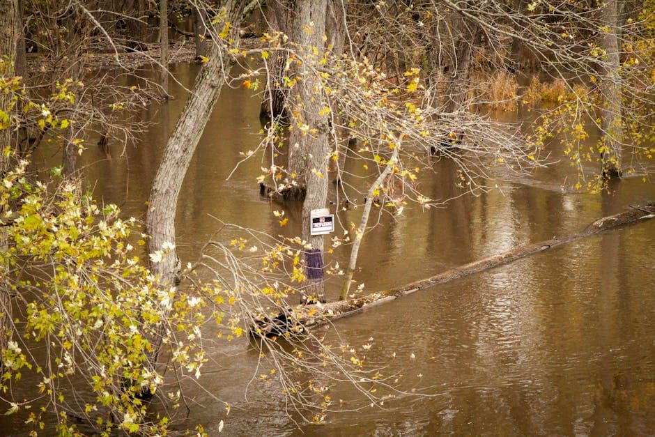
At current levels, the Tahquamenon River is nearing the high water mark set in May 1960 at 10.3 feet. Water has begun flooding low-lying areas along the Sturgeon River, including parts of the Flowing Well Campground downstream of the gauge site and the Tenmile Rapids canoe launch upstream of the gauge.
The Paint River’s elevated levels threaten several recreational facilities in Crystal Falls. At 5.0 feet, the lowest portions of the Robert Olson Walking Trail begin to flood. Should water reach 7.0 feet, waterfront park areas near the M-69 bridge and low-lying areas along the river would become inundated.
Snowmelt and Reservoir Releases Drive High Water
According to the National Weather Service in Marquette, the flooding results from ongoing snowmelt combined with increased reservoir releases. River flows remain elevated due to these conditions, with minor flooding expected to continue in affected areas.
The Sturgeon River has exceeded its bankfull stage of 8.0 feet, which also serves as the action stage for flood preparations. The Paint River exceeds bankfull stage at 5.5 feet with flows of 3,500 cubic feet per second.
Officials issued the first flood advisories on Monday afternoon, with updates continuing through Tuesday as water levels remained elevated across the region. The National Weather Service plans to issue the next statement for the Tahquamenon River at 2:00 AM EDT.
Residents and visitors in affected areas should avoid flooded roads and stay clear of swift-moving water. Additional flood safety information is available at www.weather.gov/safety/flood and www.weather.gov/marquette.


