Severe Weather Batters Michigan with Tornadoes, Floods, and Record River Levels
Multiple tornadoes touched down near Detroit while record flooding devastates rivers across Michigan, with a levee failure prompting evacuations in Cheboygan County.
DETROIT, MICHIGAN — A dangerous line of severe thunderstorms spawned multiple tornado warnings and widespread flooding across Michigan early Tuesday morning, with the National Weather Service issuing numerous weather alerts as extreme conditions continue to affect the state through Thursday night.
The Detroit/Pontiac office of the National Weather Service issued tornado warnings for areas near Downtown Detroit, Ann Arbor, Monroe, and Canton between 1:37 AM and 2:45 AM EDT, with radar detecting rotation in severe thunderstorms moving east at 60-65 mph. The storms prompted warnings for Wayne, Monroe, and Washtenaw counties.
“Flying debris will be dangerous to those caught without shelter. Mobile homes will be damaged or destroyed. Damage to roofs, windows, and vehicles will occur. Tree damage is likely,” according to the National Weather Service tornado warnings.
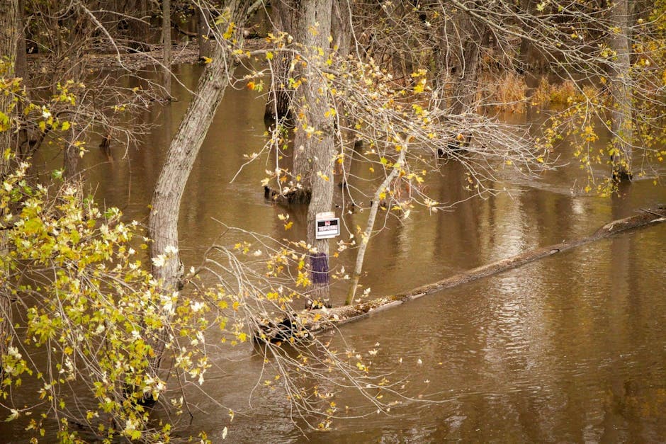
Flash Flooding and Levee Failure
A levee failure in the Little Black River Watershed in northern Cheboygan County prompted a flash flood warning until 10:00 AM EDT Wednesday. The National Weather Service emphasized the failure is “unrelated to current activities at the Cheboygan Dam.”
The affected area includes US-23 shoreline from approximately Pries Landing south to the Cheboygan River, down to Lincoln Street, back along Count Street, to Levering Road, and Inverness Trail. The flooding impacts the South Branch Little Black River, West Branch Little Black River, and Little Black River.
Flood advisories remain in effect for multiple counties in southeast Michigan, including Livingston, Macomb, Oakland, Genesee, and Saginaw counties, where Doppler radar indicated between 1 and 2 inches of rain had fallen by early Tuesday morning.
Record River Levels Across State
The Manistee River near Sherman reached 18.0 feet Tuesday evening, exceeding the previous flood record of 16.9 feet set on April 15, 2014. The river is expected to crest at 18.5 feet before gradually falling below flood stage by Monday, April 21.
The Au Sable River near Red Oak hit 8.6 feet Tuesday night and is forecast to reach 9.4 feet Wednesday morning, also exceeding flood records. Several other rivers including the Paint River at Crystal Falls, Sturgeon River near Chassell, and Chocolay River near Harvey are experiencing major or moderate flooding.
In the Upper Peninsula, significant snowpack remains over northern and eastern areas, with temperatures well above freezing continuing to accelerate snowmelt. The National Weather Service Marquette office has issued flood watches for portions of central and western Upper Michigan through late Thursday night.
Statewide Impact
Dense fog advisories cover portions of central and western Upper Michigan until 10:00 AM EDT Wednesday, with visibility reduced to one-quarter mile or less. The fog developed as low levels cooled with ample moisture remaining in place and light winds off remaining snowpack and cold Great Lakes waters.
Cities experiencing flooding include Warren, Troy, Southfield, St. Clair Shores, Pontiac, Novi, Mount Clemens, Hartland, New Baltimore, Fenton, Howell, Brighton, Milford, Holly, Richmond, Romeo, Oxford, Fowlerville, Pinckney, Sterling Heights, Saginaw, Frankenmuth, Clio, Chesaning, St. Charles, Birch Run, Zilwaukee, Montrose, Merrill, and Bridgeport.
A tornado watch issued at 8:55 PM EDT Monday remained in effect until 4:00 AM EDT Wednesday for 17 counties in southeast Michigan and five counties in southwest Michigan, including Bay, Genesee, Huron, Lapeer, Lenawee, Livingston, Macomb, Midland, Monroe, Oakland, Saginaw, Sanilac, Shiawassee, St. Clair, Tuscola, Washtenaw, and Wayne counties.
The National Weather Service warns that excessive runoff may result in continued flooding of rivers, creeks, streams, and other low-lying and flood-prone locations through late Thursday night, with additional rainfall amounts of 1 to 4 inches possible in some areas.


