Flood Warnings, Advisories Issued Across Michigan’s Upper Peninsula
Multiple flood warnings issued as snowmelt and heavy rain push Upper Peninsula rivers toward record levels, threatening roads and homes.
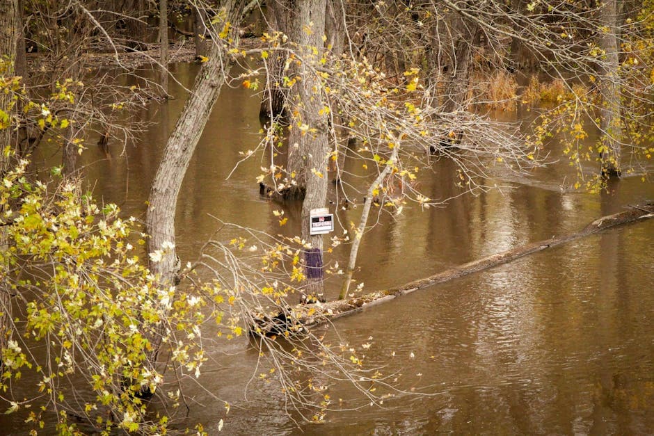
MARQUETTE, MICHIGAN — The National Weather Service has issued multiple flood warnings and advisories across Michigan’s Upper Peninsula as warming temperatures accelerate snowmelt and heavy rain threatens to push rivers to critical levels.
The Sturgeon River near Nahma Junction in Delta County reached 10.2 feet Monday night, triggering a flood warning for minor flooding that approaches the flood of record. The current level exceeds the 10.0-foot flood stage and compares to a previous crest of 10.4 feet recorded on April 7, 1986.
“Water floods low lying areas along the river,” according to the National Weather Service warning. “This may include parts of the Flowing Well Campground downstream of gauge site and the tenmile rapids canoe launch upstream of the gauge site.”
Multiple Rivers at Risk
The Sturgeon River near Alston, affecting Baraga and Houghton counties, is also under a flood warning with minor flooding occurring. The river stood at 8.1 feet Monday evening, above the 7.5-foot bankfull stage.
At 11.0 feet, “additional homes and structures near the river are impacted and evacuations may be necessary,” weather officials warned. “Water levels may reach the bottom of Froberg bridge in addition to other bridges that cross the river.”
The Michigamme River near Republic in Marquette County remains under a flood advisory, with the water level at 5.0 feet as of Monday afternoon. The river is forecast to rise to 8.5 feet by Monday morning, just above the 8.4-foot action stage.
Road Flooding Expected
Several county roads face flooding threats as water levels rise. At the Michigamme River, water begins impacting yards near Bengtson bridge on County Road LI in South Republic at 7.7 feet. At 10.0 feet, portions of County Roads 601, LE and LG would experience significant flooding.
The Middle Branch Escanaba River at Humboldt in Marquette County stood at 4.6 feet Monday evening and is expected to crest at 6.0 feet Saturday morning. County Road FX begins flooding at 6.5 feet, with water reaching the bottom of the County Road FX bridge at 7.0 feet.
The Black River near Bessemer in Gogebic County reached 9.8 feet Monday night, approaching the 10.0-foot flood stage. Water at flood stage impacts low-lying areas of properties along Black River Road and Hedberg Road.
Widespread Flood Watch
A flood watch remains in effect through Wednesday morning for large portions of central and western Upper Michigan, including Alger, Baraga, Delta, Dickinson, Gogebic, Iron, Keweenaw, Luce, Marquette, Menominee, Northern Houghton, Southern Houghton, Northern Schoolcraft, Southern Schoolcraft and Ontonagon counties.
“Heavy rain may fall on a deep primed snowpack leading to the melt increasing,” the National Weather Service stated. “Flows in rivers may increase quickly and reach critical levels.”
Weather officials warn that excessive runoff may result in flooding of rivers, creeks, streams and other low-lying and flood-prone locations. Flooding may also occur in areas with poor drainage and urban areas.


