Strong Thunderstorms Sweep Southwest Missouri, Wind Gusts Reach 55 MPH
Thunderstorms with 55 mph winds and penny-sized hail swept through southwest Missouri overnight, affecting dozens of communities along Interstate 44.
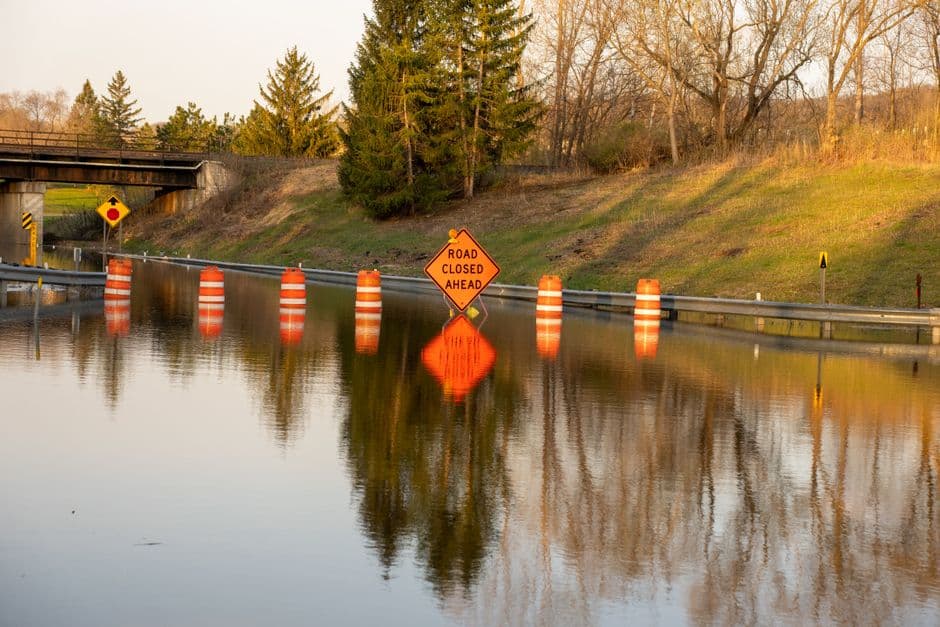
CARTHAGE, MISSOURI — Strong thunderstorms swept across southwest Missouri early Thursday morning, bringing wind gusts up to 55 mph and penny-sized hail as they moved eastward at 50 mph, according to the National Weather Service Springfield office.
The weather service issued special weather statements tracking the storm system as it progressed through the region. At 12:30 a.m. CDT Thursday, Doppler radar showed strong thunderstorms extending from seven miles east of Lamar to near Alba to near Diamond to near Goodman.
The storms posed hazards including wind gusts up to 50 mph and half-inch hail, with radar indicating the potential for gusty winds to knock down tree limbs and blow around unsecured objects, while minor hail damage to vegetation remained possible.
Multiple Communities in Storm’s Path
The weather service warned that numerous communities lay in the storm’s path. Locations impacted included Carthage, Neosho, Stockton Lake, Monett, Aurora, Mount Vernon, Lamar, Marionville, Granby, Greenfield, Sarcoxie, Pierce City, Purdy, Lockwood, Jasper, Diamond, Golden City, Miller, Verona, and Fairview.
Interstate 44 experienced storm conditions between mile markers 14 and 58, according to the weather service alert.
Earlier Storm Activity
The Thursday morning storms followed an earlier round of severe weather that moved through the area Wednesday night. At 11:56 p.m. CDT Wednesday, radar tracked strong thunderstorms along a line extending from six miles north of Liberal to seven miles east of Mindenmines to near Galena to near Wyandotte, moving east at 45 mph.
That earlier system brought wind gusts of 50 to 55 mph and penny-sized hail to a broader area including Joplin, Carthage, Neosho, Webb City, Prairie State Park, Carl Junction, Lamar, Baxter Springs, Galena, Oronogo, Seneca, Granby, Carterville, Duquesne, Sarcoxie, Duenweg, Jasper, Diamond, Golden City, and Liberal.
The Wednesday night storms affected Interstate 44 between mile markers 0 and 31, with the same hazards of tree limb damage and potential harm to unsecured objects from the powerful wind gusts.