Flash Flood Warning Issued for Southwest Missouri, Southeast Kansas
Thunderstorms dump up to 4 inches of rain across Missouri-Kansas border region, prompting flash flood warning for multiple counties until early afternoon.
JOPLIN, MISSOURI — The National Weather Service issued a flash flood warning Tuesday morning for parts of southwest Missouri and southeast Kansas after heavy thunderstorms brought up to 4 inches of rain to the region.
The warning, issued at 7:14 a.m. and effective until 1:15 p.m., covers southeastern Cherokee County in Kansas, southern Jasper County in Missouri, and Newton County in Missouri. Doppler radar and automated rain gauges detected thunderstorms producing heavy rainfall throughout the warned area.
“Between 3 and 4 inches of rain have fallen. Additional rainfall amounts up to 1 inch are possible in the warned area,” according to the National Weather Service in Springfield. “Flash flooding is ongoing or expected to begin shortly.”
Communities at Risk
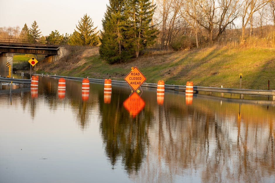
Multiple cities and towns face immediate flooding threats as water levels continue to rise. The National Weather Service identified specific locations expected to experience flash flooding, including Joplin, Neosho, Baxter Springs, Webb City, Galena, Seneca, Granby, Duquesne, Sarcoxie, Duenweg, Diamond, Leawood, and Silver Creek.
Weather officials warn that flash flooding will impact small creeks and streams, urban areas, highways, streets and underpasses, as well as other poor drainage and low-lying areas throughout the region.
Safety Concerns
The flash flood warning highlights the dangerous conditions created by the thunderstorms that moved through the area overnight and into the early morning hours. With radar and automated gauges confirming the heavy rainfall totals, emergency management officials are monitoring water levels across the affected counties.
The warning encompasses a significant portion of the Missouri-Kansas border region, where topography and drainage systems make communities particularly vulnerable to rapid water accumulation during heavy rain events.
Weather Service Response
The National Weather Service categorized the threat as flash flooding caused by thunderstorms, with radar and automated gauges serving as the primary sources for the warning. The Springfield office continues to monitor conditions as the storm system moves through the area.
Residents in the warned counties should remain alert for rapidly changing conditions and avoid driving through flooded roadways. The warning remains in effect through the early afternoon as additional rainfall could exacerbate existing flooding conditions.