Platte River Flooding Continues Near Platte City Through Tuesday
The Platte River near Platte City is expected to crest at 21.5 feet this afternoon, flooding cropland and affecting Platte County agricultural areas until Tuesday.
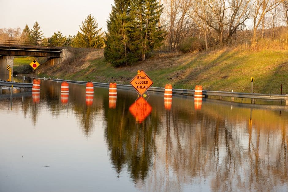
PLATTE CITY, MISSOURI — Minor flooding along the Platte River near Platte City is expected to continue through late Tuesday night, according to a flood warning issued by the National Weather Service Kansas City/Pleasant Hill office.
The river reached 20.9 feet at 4:30 AM Sunday, exceeding the 20-foot flood stage. The National Weather Service forecasts the river will crest at 21.5 feet this afternoon before gradually receding below flood stage early Tuesday morning.
Current Flooding Impacts
Cropland near State Highway 92 near Platte City has begun flooding as water levels surpassed the 20-foot mark. The flooding affects agricultural areas in Platte County, with conditions expected to worsen as the river approaches its predicted crest.
At the current stage of 20.9 feet, the river remains below the 22-foot level that would trigger more extensive flooding. When water reaches 22 feet, flooding occurs at Humphreys Access Area, located five miles downstream from Platte City, and inundates approximately 300 acres of pasture land.
Timeline and Forecast
The flood warning remains in effect until 1:00 AM Tuesday, June 17. River levels are expected to peak this afternoon at 21.5 feet before beginning a gradual decline.
The National Weather Service indicates the river should fall below the 20-foot flood stage by early Tuesday morning, marking the end of the current flooding event. Weather officials continue monitoring conditions along the Platte River and surrounding tributaries in the region.
Residents and farmers in affected areas should exercise caution near flooded roadways and agricultural land. The National Weather Service recommends avoiding driving through flooded roads and staying informed about changing river conditions through official weather updates.


