Flash Floods Strike Missouri, Hitting Kansas City Area and St. Charles County
Thunderstorms dumped up to 4.5 inches of rain across parts of Missouri on June 25, triggering flash flood warnings from Kansas City to the St. Louis suburbs — including a stretch of Interstate 70.
KANSAS CITY, MISSOURI — Severe thunderstorms moved through Missouri on the evening of June 25, leading to multiple Flash Flood Warnings from two National Weather Service offices. Floodwaters affected streets, highways, and low-lying areas in both the Kansas City region and the St. Louis suburbs.
Kansas City Area Hit with Up to 4.5 Inches of Rain
The National Weather Service office in Pleasant Hill, Missouri issued a Flash Flood Warning at 8:01 p.m. CDT for northwestern Henry County in west central Missouri, valid until 10:30 p.m. CDT. Doppler radar indicated thunderstorms had already dropped between 2 and 3 inches of rain across the warned area, with flash flooding ongoing or expected to begin shortly.
By 8:32 p.m. CDT, public reports confirmed thunderstorms were still producing heavy rain across the same region. Rainfall totals reached between 3 and 4.5 inches, according to the NWS Kansas City/Pleasant Hill office. Flash flooding was confirmed as ongoing at that time, with the warning remaining in effect until 10:30 p.m. CDT.
The community of Creighton was specifically identified in both Kansas City-area warnings as a location expected to experience flash flooding.
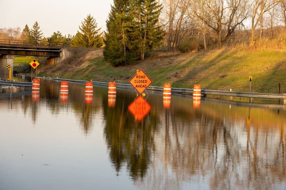
St. Charles County Flooding Closes Part of Interstate 70
In the east, the National Weather Service office in St. Louis issued a Flash Flood Warning at 4:18 p.m. CDT for central Saint Charles County, with flash flooding ongoing or expected to begin shortly after between 1 and 3 inches of rain had already fallen. That warning was set to expire at 8:15 p.m. CDT.
A follow-up advisory issued at 6:14 p.m. CDT noted that the thunderstorms producing heavy rain had largely ended, but runoff from the storms was still occurring. Residents were urged to remain aware of ongoing flash flooding throughout the area.
The St. Louis NWS office identified the following communities as affected by the Saint Charles County flooding:
- O’Fallon
- St. Charles
- St. Peters
- Dardenne Prairie
- Weldon Spring
- Cottleville
- St. Paul
- Weldon Spring Heights
- Harvester
- Kampville
The flooding in Saint Charles County also affected the First Missouri State Capitol Historic Site state park, according to the NWS St. Louis. Interstate 70 in Missouri between exits 216 and 229 was among the roadways included in the flash flood warning area.
Low-Lying Areas, Urban Streets Among Most Vulnerable
Across both warned regions, the National Weather Service described similar impacts: flash flooding of small creeks and streams, urban areas, highways, streets and underpasses, and other poor drainage and low-lying areas.
The Kansas City-area warnings were sourced from both Doppler radar data and public reports, while both St. Louis-area warnings were radar-indicated, according to the respective NWS offices.
Residents in all affected areas were advised to avoid flooded roadways and to move to higher ground if threatened by rising water. The National Weather Service standard guidance applies: turn around, don’t drown.


