Big Creek Flooding Continues in West-Central Missouri After Severe Weather
Big Creek flooding continues in Johnson, Henry and Cass counties following severe weather that brought confirmed tornadoes to the region Sunday night.
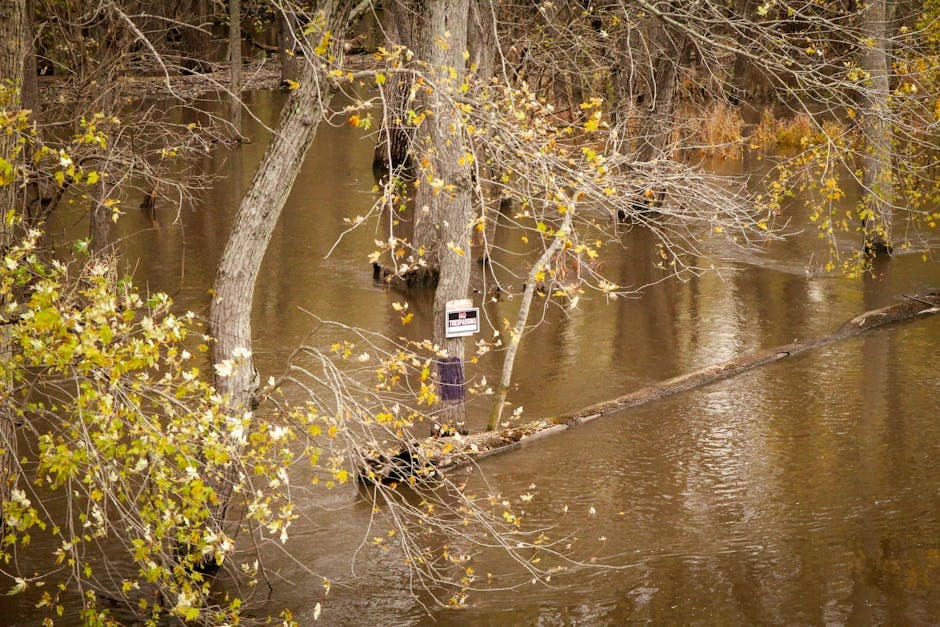
BLAIRSTOWN, MISSOURI — Big Creek at Blairstown remained above flood stage Tuesday morning as multiple flood warnings from the National Weather Service continue through Thursday evening, affecting Johnson, Henry, and Cass counties following severe weather that brought tornadoes to the region.
The creek reached 22.4 feet at 6:00 AM CDT Tuesday, according to the National Weather Service Kansas City/Pleasant Hill office. The waterway is forecast to crest at 22.9 feet Tuesday afternoon before gradually falling below the 20.0-foot flood stage by Thursday evening.
Transportation Impacts and Flooding Areas
Minor flooding is occurring along the west bank of Big Creek, with water levels approaching the threshold for more significant impacts. At 23.0 feet, flooding would affect the west approach to the N Highway bridge located 0.2 miles west of Blairstown and would also impact B Highway near Big Creek, several miles northwest of Blairstown.
The current water level of 22.4 feet remains below the 23.0-foot threshold that would cause roadway flooding, but officials continue monitoring conditions closely.
Severe Weather Preceded Flooding
The flooding followed a night of severe weather Sunday that brought multiple tornadoes and tornado warnings to west-central Missouri. Weather spotters confirmed a tornado near Mound City at approximately 8:15 PM CDT on April 13, prompting tornado warnings for several counties.
The severe thunderstorm system moved eastward at 30 mph, producing quarter-size hail and radar-indicated rotation as it tracked through Bates County. Tornado warnings were issued for communities including Butler, Adrian, Passaic, Ballard, Pleasanton, and Hume as the system progressed through the region.
A tornado watch remained in effect for Cass, Henry, and Johnson counties until 11:00 PM CDT Sunday, covering cities including Belton, Clinton, Harrisonville, Pleasant Hill, Raymore, Warrensburg, and Windsor.
Creek Levels and Forecast
Big Creek water levels rose from 18.2 feet at 11:00 PM CDT Monday to exceed flood stage by Tuesday morning. The National Weather Service issued the first flood warning late Monday night as conditions deteriorated rapidly.
After reaching its forecast crest of 22.9 feet Tuesday afternoon, the creek is expected to fall to 13.2 feet by Thursday morning, then rise again to 14.9 feet Friday morning before falling and remaining below flood stage.
Residents in affected areas should avoid flooded roadways and monitor local conditions. The National Weather Service provides updated flood safety information at weather.gov/safety/flood.


