Flash Flood Watch, High Surf Warnings Hit Gulf Coast Friday
The National Weather Service has placed northwest Florida, coastal Alabama, and parts of southeast Mississippi under a Flash Flood Watch and High Surf Advisory through Friday evening, with rip current dangers extending into Saturday.
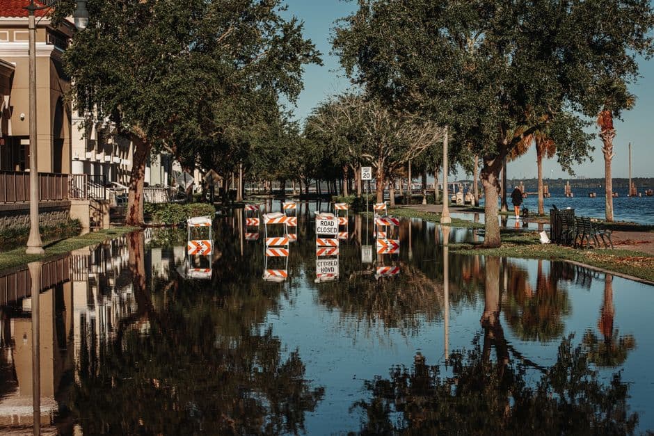
PENSACOLA, FLORIDA — The National Weather Service office in Mobile, Alabama issued multiple weather alerts Friday morning for portions of northwest Florida, southwest Alabama, and southeast Mississippi, warning residents of flash flooding, dangerous surf, and hazardous rip currents through the evening hours.
Flash Flood Watch in Effect Through 6 PM
A Flood Watch issued at 7:03 a.m. CDT Friday remains in effect until 6:00 p.m. CDT for a wide stretch of the central Gulf Coast region. The watch covers northwest Florida counties including Escambia Coastal, Escambia Inland, Okaloosa Coastal, Okaloosa Inland, Santa Rosa Coastal, and Santa Rosa Inland.
The same watch extends into portions of Alabama, covering Baldwin Central, Baldwin Coastal, Baldwin Inland, Butler, Choctaw, Clarke, Conecuh, Covington, Crenshaw, Escambia, Mobile Central, Mobile Coastal, Mobile Inland, Monroe, Washington, and Wilcox counties. In southeast Mississippi, George, Greene, Perry, Stone, and Wayne counties are also included.
According to the National Weather Service, another round of storms is expected to develop Friday, sustaining the threat of flash flooding. Forecasters noted that soils across the region are already heavily saturated, which increases the risk of rapid runoff into rivers, creeks, streams, and low-lying areas. Extensive street flooding and rising water levels in creeks and rivers are possible throughout the day.
High Surf and Dangerous Rip Currents Along Coastal Areas
A High Surf Advisory was also issued at 6:58 a.m. CDT Friday, running concurrently until 6:00 p.m. CDT. The advisory covers coastal areas in both states, including Mobile Coastal and Baldwin Coastal counties in Alabama, and Escambia Coastal, Santa Rosa Coastal, and Okaloosa Coastal counties in Florida.
Breaking waves of 4 to 5 feet are expected in the surf zone, according to the National Weather Service. Conditions are expected to produce dangerous swimming and surfing environments, along with localized beach erosion along affected shorelines.
A separate Rip Current Statement, also issued at 6:58 a.m. CDT, extends the rip current danger through Saturday afternoon, June 20, at 6:00 p.m. CDT for the same coastal counties. The National Weather Service warned that rip currents pose a threat even to strong swimmers, noting that the currents can pull people away from shore and into deeper water.
What Residents and Beachgoers Should Know
Residents in flood-prone neighborhoods are urged to avoid driving through standing water and to stay away from swollen streams and drainage areas. Officials warn that flood conditions can develop rapidly, especially with saturated ground unable to absorb additional rainfall.
Beachgoers are advised to stay out of the water along Gulf Coast beaches until the High Surf Advisory and Rip Current Statement expire. The National Weather Service cautioned that rip currents remain a threat through Saturday afternoon, meaning coastal hazards will persist beyond the Friday evening expiration of the surf advisory.
All alerts were issued by the National Weather Service office in Mobile, Alabama. Residents should monitor local forecasts for updated information as storm conditions evolve throughout the day.


